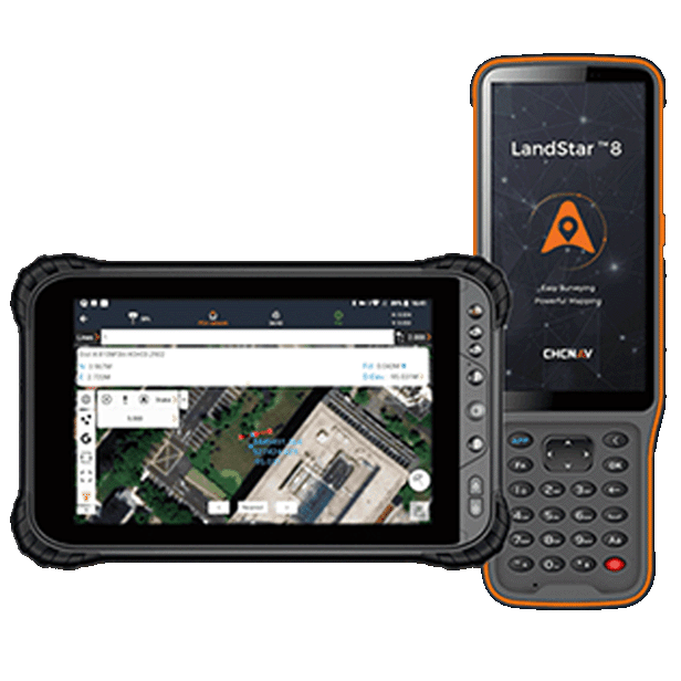
CHCNAV LandStar
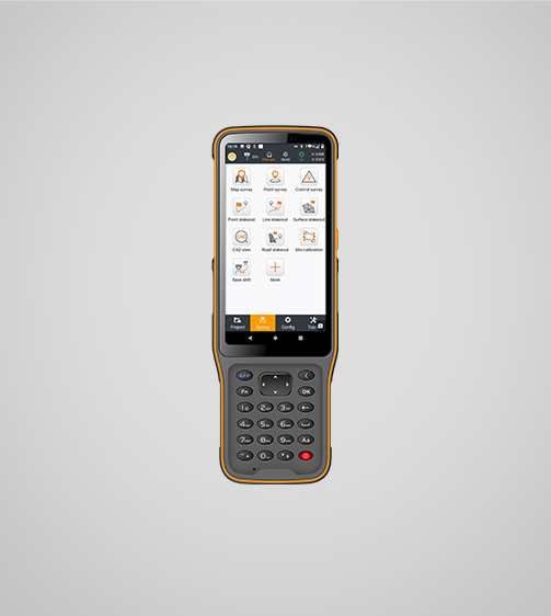
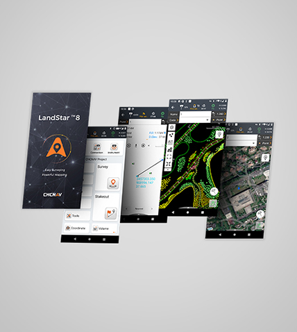
LandStar 8 is a trusted data collection app for Android devices and CHCNAV controllers, streamlining high-precision surveying and mapping with easy-to-use workflows and an intuitive graphical interface. It includes all necessary surveying functions such as construction surveying, control point measurements, CAD support, and efficient stakeout of points, lines, and surfaces. Compatible with industry-standard data formats for seamless import and export, LandStar 8 ensures immediate productivity gains.
MetaCAD Engine
Open DWG and DXF base maps fast and with smoother rendering.
Cloud Connectivity
Project backup, collaborative work and remote support.
Modular
Customizable user interface for ease-of-use.
Comprehensive
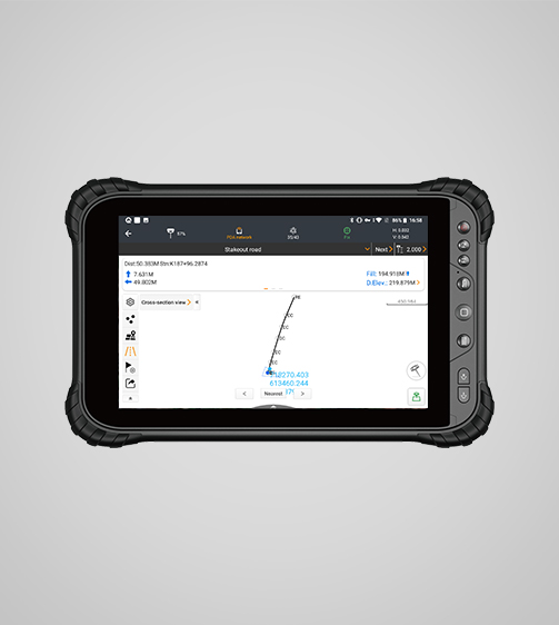
Construction surveying, CAD support, and efficient stakeout.
Use cases
- Topographic Surveying
- Construction Layout
- Earthwork Volume Calculations
- Road Surveys
- Cadastral Mapping
Product details
| Brand | CHCNAV |
|---|---|
| Model | LandStar |
| System | |
| Operating system | Android |
| Languages | Over 35 supported |
| Connectivity | |
| Networking | Bluetooth, Wi-Fi |
| Cloud | Data storage and remote support |
| Features | |
| Functions | Data collection, stakeouts and more. |
| File formats | SHP, DWG, DXF, KML, GPX, TIFF, JPG, MBTiles |
| Interface | |
| User menu | Customizable |
| Online basemaps | Google, Bing, WMS, WFS |